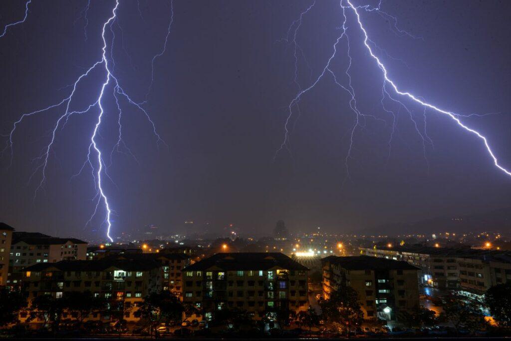
Quick Answer: The Met Office has issued yellow thunderstorm warnings for a large area of England and Wales for Wednesday 26 and Thursday 27 August 2026. Expect heavy downpours, hail and lightning, with a risk of flash flooding, travel chaos and even power cuts.
The long dry summer has finally cracked. After weeks of sunshine, the rain is barging back in.
- Yellow storm warnings hit England and Wales on both Wednesday and Thursday.
- Wednesday’s warning runs from 3am to 10pm, and Thursday’s runs from 6am to 10pm.
- Some areas could cop 40–50mm in two to three hours, and even 75mm is possible over east-facing hills.
- Flash flooding is a real worry because the ground is baked rock-hard.
- July 2026 was the driest July on record for England and Wales.
- Your weather app might miss the storms, so check the hourly icons.
Where and When the Storms Hit
Wednesday’s warning kicked in at 3am and runs to 10pm. It got tweaked that morning to cover northern and eastern Wales, north-west England, the Midlands, and parts of eastern and southern England. After early cloud and rain, sunny spells break out, and then thundery showers pop up in the afternoon.
Sky News flags the storm band running from Manchester down to London. Northern Ireland sees lighter showers with less thunder, while most of Scotland stays dry bar the odd south-western shower later. Thursday then brings a second warning, from 6am to 10pm, over much the same patch.
How Much Rain and the Dangers
Where the storms land, 20–30mm could tip down in under an hour. In the worst spots, that’s 40–50mm over two or three hours. Thursday looks even soggier: 20–30 mm in three hours fairly widely and up to 50 mm in 12 hours in places.
There’s a small chance east-facing hills could cop over 75 mm in 12 hours – serious flood risk. Add large hail of 1–2 cm, near-constant lightning, and gusty winds across southern England early Thursday.
Also read: Marks and Spencer to Close 14 In-Store Cafés Across the UK in 2026
Flood Fear After a Record Dry Spell
The Environment Agency put five flood alerts in place, covering watercourses around Loughborough, the River Leen, Day Brook and Tottle Brook, the River Maun, River Trent tributaries in Nottinghamshire, and streams in Leicester.
After months of drought, the ground is set like concrete. Rain can’t soak in, so it runs off and pools. That means flash flooding, closed roads and dodgy driving. Homes and businesses could flood fast, with damage from floodwater, lightning or hail, and buses and trains may stop too.
Why the Storms are Finally Back
For weeks, high pressure sat on the UK like a lid, squashing storms before they grew, and the jet stream sat further north than usual. Now that lid lifts. Colder air is sliding in high up while warm, humid air hangs near the ground, so the air turns unstable and builds towering storm clouds.
Low pressure is spinning up over Iberia before tracking towards France and the UK, dragging the muggy air north. Western Europe has already had a taste, including severe storms and a tornado in southern France.
Why Has It Been So Dry?
July 2026 was the driest July on record for both England and Wales, in records going back to 1836, and southern England had its driest calendar month ever. Figures from the BBC show Brize Norton in Oxfordshire caught just 0.4 mm this August and 1 mm in July.
Kew Gardens? Not a drop in July, and only 1.8mm so far this month. The Independent notes five back-to-back heatwaves have left almost three-quarters of England and the whole of Wales in drought. It also flags 2026 as the first year on record with three separate days at 37°C and four at 36°C or above.
What the Met Office Says
Met Office chief forecaster Steve Willington pointed to a “growing risk of heavy rain and thunderstorms” as warm, humid air fires things up. Some places, he reckons, could see a lot of rain in a short burst, bringing local flooding, travel disruption and frequent lightning.
Thursday’s slow-moving thundery rain may dump prolonged downpours on some areas. There’s still uncertainty about where the heaviest rain will fall, so check the latest forecasts.
Also read: EasyJet Flight EZY861 Declares Squawk 7700: What Happened on Board?
Why Your Weather App May Miss It
Don’t be surprised if your phone says ‘dry’ while it’s chucking it down. Thunderstorms can be unpredictable — one street floods while the next village stays dry.
Forecasters know storms are brewing, as warm, moist air below meets colder air above and up it goes. But the models can’t nail exactly where each one pops. Picture popcorn in a pan: you know kernels will pop, but not which or when, and some never do. Some storms fire overnight too, so they won’t always show in the daily icons. Your best bet is the hourly symbols and rain percentages.
How to Stay Ready
Guidance shared by AOL says to gather your essentials and make up an emergency flood kit. It also notes the warning grew from 59 areas to 65. Pin down anything that could blow away – bins, garden furniture, trampolines, tents, gazebos, sheds and fences. Charge your phone in case the power drops, and leave extra time if you’re driving.
The Days Ahead
Thursday is the day to watch. The showers may eventually reach southern Scotland and Northern Ireland but weaken as they drift north. After that, low pressure keeps rain and heavy showers coming from Friday to Sunday, with temperatures easing to nearer average around 26°C in London on Thursday.
Storms could even return to Manchester and Newcastle on Sunday afternoon. Over the bank holiday weekend, expect showers, longer spells of rain and strong winds. It stays changeable into early September, with above-average rainfall, though the far south may turn drier and warmer later.
FAQs
Q. When are the thunderstorm warnings in place?
A. Yellow warnings run Wednesday 26 August, 3am–10pm, and Thursday 27 August, 6am–10pm, both across England and Wales.
Q. How much rain could actually fall?
A. Some spots may see 40–50 mm in two to three hours, while east-facing hills could top 75 mm in 12 hours, which poses a flood risk.
Q. Which areas are most at risk?
A. London, the South East, the Midlands, East Anglia, parts of the North West and South West, and large parts of Wales.
Q. Why is flooding a big worry after a dry summer?
A. Baked, hard ground can’t soak up heavy rain, so it runs off, and flash flooding hits fast.
Q. Why might my weather app not show the storms?
A. Storms are small and patchy, so models struggle to place them, and some fires are at night, so daily icons miss them.
Q. What should I do to get ready?
A. Sort an emergency flood kit, tie down loose garden bits, charge your phone, and allow extra time for journeys.
Sources & References:
- BBC – Brize Norton in Oxfordshire caught just 0.4 mm of rain this August and 1 mm in July.
- AOL – Gather your essentials and make up an emergency flood kit.
- Independent – Five back-to-back heatwaves have left almost three-quarters of England and the whole of Wales in drought.
- Sky News – The storm band is running from Manchester down to London.